Unless you are still in denial, you will be aware that climate change is a very real thing that we should all be concerned about.
Harrowing images from around the globe will show you exactly what dangers we are currently facing and let's not forget about those melting ice caps.
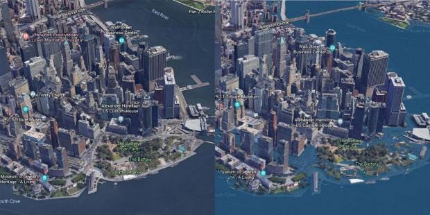
To give the public a better understanding of the dangers that we are facing, the research group Climate Central have created a unique plug-in for Google Earth that gives you a virtual demonstration of how the world may look in the future, according to predictions for 2100.
These calculations were based on research conducted by the National Oceanic and Atmospheric Agency in 2017 and show what would happen in a worst case scenario should sea levels experience an extreme rise.
You can download and install the plug-in via the Climate Central website but here.
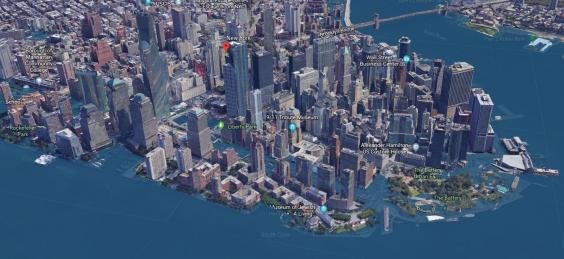
Most of New York City's major financial area would be flooded with water from the Hudson River seeping into Brooklyn and the West Village.
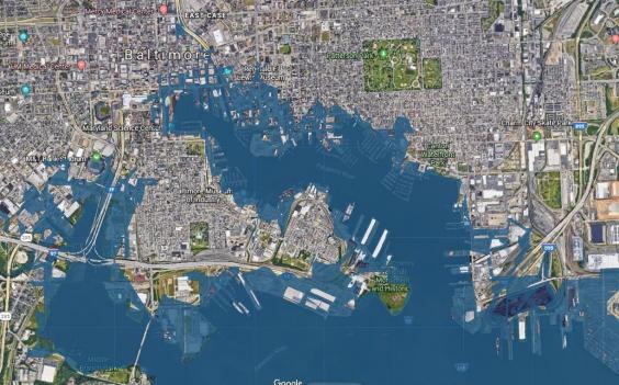
Baltimore, Maryland has one of the biggest seaports in America and unsurprisingly would see a huge surge in levels.
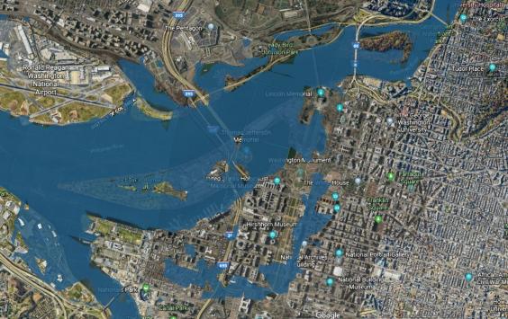
Despite not being close to a coastline Washington DC would see most of its monuments ruined by water, although the White House just manages to escape.
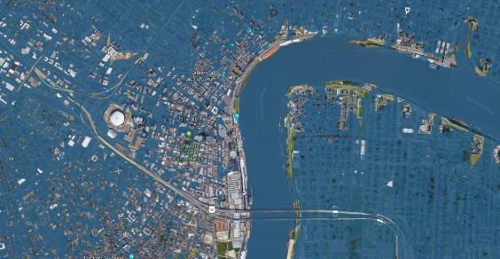
New Orleans, which suffered one of the worst floods in American history, would be practically submerged by 2100.
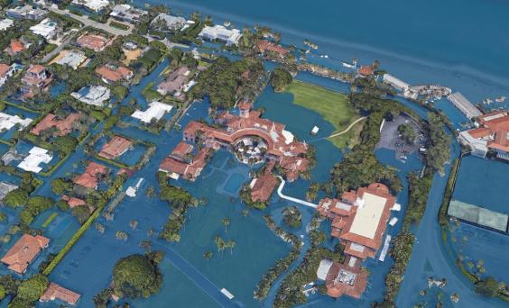
What of Donald Trump - who is a notorious climate change denier - and his luxury Mar-A-Lago resort in Florida?
Well, it would be completely unusable.
Other US cities that would be majorly affected included Boston, Las Vegas and San Francisco, while others like Houston and Los Angeles would only experience a small rise.
Unfortunately, the plug-in only works for American cities at the moment and we can't see what would happen anywhere else in the world.